

 20Likes
 LinkBack URL
 About LinkBacks
Legend mate
Welcome guest, is this your first visit? Create Account now to join.
Welcome to the NZ Hunting and Shooting Forums.
Search Forums


User Tag List
+ Reply to Thread
Results 46 to 60 of 78
Thread: Garmin Monterra GPS
-
17-12-2013, 11:11 AM #46Member

- Join Date
- Aug 2012
- Location
- Christchurch
- Posts
- 4,465
-
-
17-12-2013, 11:13 AM #47Sending it

- Join Date
- Feb 2013
- Location
- The Hill
- Posts
- 23,208
Or pay for birds eye Originally Posted by SIKAHUNTER


Garmin | United Kingdom | Garmin Recreational Maps
-
17-12-2013, 11:15 AM #48Muppets Inc.

- Join Date
- Jun 2012
- Location
- Napier
- Posts
- 303
http://l.bitcasa.com/Ru7E98Wf
Above is the link to a sample satellite overlay that'll hopefully work on compatible Garmins. Let me know if it works as I don't have a unit here yet to try it on. The sample area is just north of Kaweka Flats Biv in Kaweka Ranges.
Simon
-
17-12-2013, 11:20 AM #49Muppets Inc.
- Join Date
- Jun 2012
- Location
- Napier
- Posts
- 303
Yeah true, does it cover NZ? Originally Posted by Gibo
-
17-12-2013, 11:23 AM #50Sending it
- Join Date
- Feb 2013
- Location
- The Hill
- Posts
- 23,208
Yeah mate has it for his Oregon 450. From memory its $50NZ per year for PC. You then load selected areas onto your device and once done its there for ever. So a device with good internal mem is going to be able to take more. Originally Posted by SIKAHUNTER
-
17-12-2013, 11:34 AM #51Almost literate.

- Join Date
- Dec 2011
- Location
- Nelson
- Posts
- 24,766
What's the detail like and how old are the pics? Can you zoom right in on it? Originally Posted by Gibo
"Hunting and fishing" fucking over licenced firearms owners since ages ago.
308Win One chambering to rule them all.
-
17-12-2013, 11:38 AM #52Sending it
- Join Date
- Feb 2013
- Location
- The Hill
- Posts
- 23,208
Not sure of the exact zoom levels VC but when we were out in the central north we were using it to hop from clearing to clearing. The detail is similar to google earth (shit in my opinion) Originally Posted by veitnamcam
What we did find is that the iPhone maps (not google) have more detail (could pick a grassy clearing from a swamp).
I cannot justify the money just to have a sat picture of an area that I could just as easily print of google.......
-
17-12-2013, 11:49 AM #53Muppets Inc.
- Join Date
- Jun 2012
- Location
- Napier
- Posts
- 303
I find Microsoft's Bing Sat pics to be of a better quality than Google.
-
17-12-2013, 11:58 AM #54Member
- Join Date
- Aug 2013
- Location
- Christchurch
- Posts
- 449
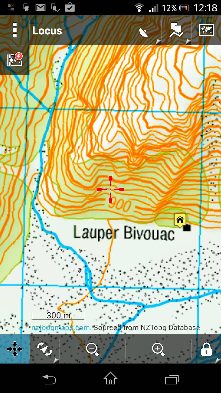
Which screenshot? The one you posted on the previous page seems to have contour lines every 100m according to the scale at the bottom. Originally Posted by SIKAHUNTER
If you can get 1:50,000 for free on Locus then i'd be impressed!
Do you know of a way to add DOC boundaries to it? I have my budget way, but it'd be great to have really accurate overlays for them.
-
17-12-2013, 12:02 PM #55Sending it
- Join Date
- Feb 2013
- Location
- The Hill
- Posts
- 23,208
Shit yes, thanks mate thats way clearer to look at Originally Posted by SIKAHUNTER

-
17-12-2013, 12:14 PM #56Muppets Inc.
- Join Date
- Jun 2012
- Location
- Napier
- Posts
- 303
Mate you do realize the distance between contour lines as viewed on a map vary with the gradient of the terrain? On flat ground contour lines can be kilometers apart or non-existent, on a near cliff stacked right next to each other. Contour spacing as viewed has nothing to do with map scale. Originally Posted by MattyP
Mate I'd put my left nut on the line that it's 1:50000... fuck it and my right one too!
-
17-12-2013, 12:22 PM #57Muppets Inc.
- Join Date
- Jun 2012
- Location
- Napier
- Posts
- 303
@MattyP a South Island example might make it more obvious
-
17-12-2013, 12:28 PM #58Muppets Inc.
- Join Date
- Jun 2012
- Location
- Napier
- Posts
- 303
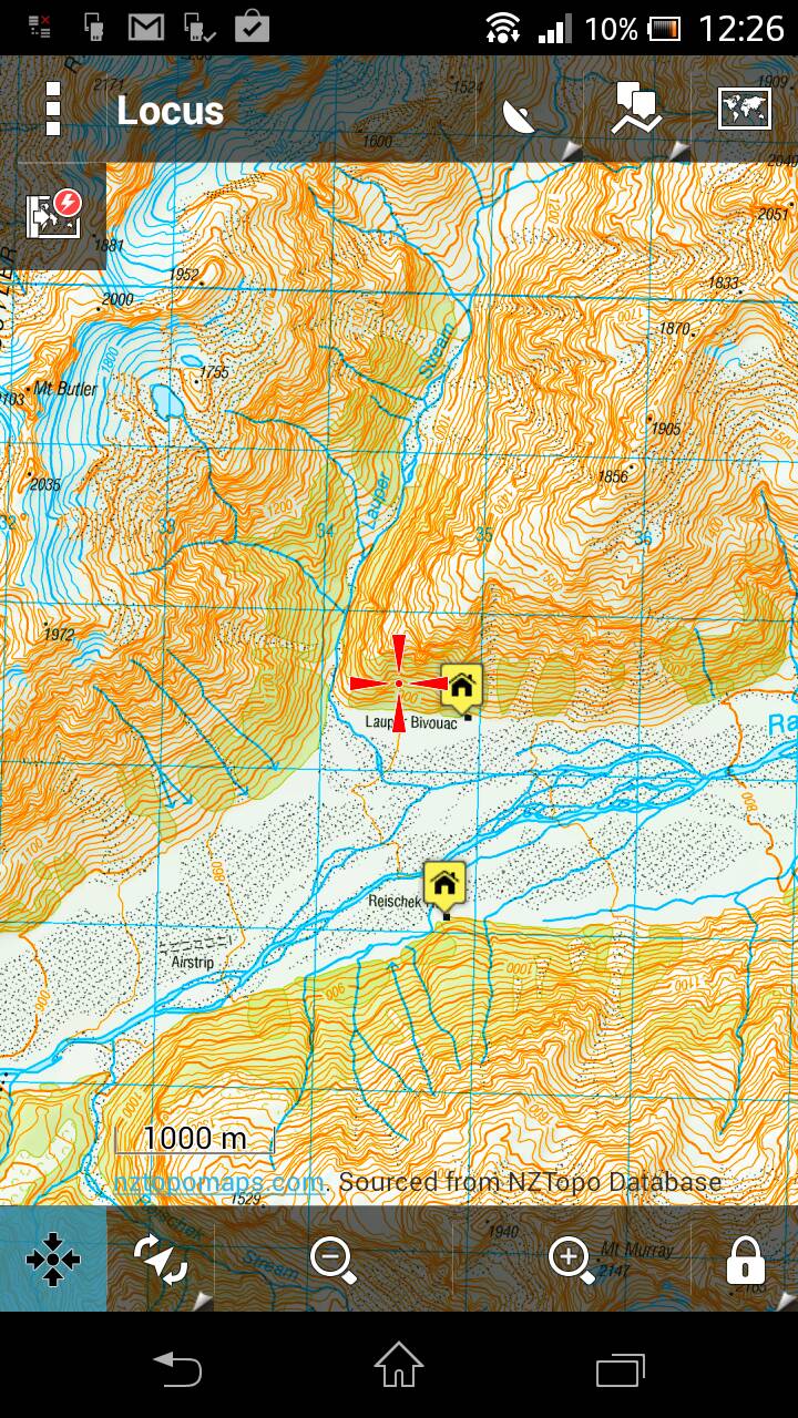
And one more for good measure, this time zoomed out a bit. The actual picture on-screen is clearer than the attached pic, I guess it's compressed somewhere along the way.
As for DOC boundaries I know you can download the DOC boundaries for the entire country on koordinates website but it is a huge ass csv file that'd need converting to kml. Shame you can't just download the area you want as the website gives you the option to download as a.kml file but the entire country is too large apparently. You'd need to cut and convert the areas of interest from the csv file.Last edited by SIKAHUNTER; 17-12-2013 at 12:39 PM.
-
17-12-2013, 12:53 PM #59Sending it
- Join Date
- Feb 2013
- Location
- The Hill
- Posts
- 23,208
Some reading here but arsed if i'm going to try it
http://www.nzhuntingandshooting.co.n...e-please-6704/
-
17-12-2013, 01:07 PM #60Muppets Inc.
- Join Date
- Jun 2012
- Location
- Napier
- Posts
- 303
Me either my poor computer just about had a hernia opening the koorinates data file, think I'll just stick to wearing a balaclava Originally Posted by Gibo


 Reply With Quote
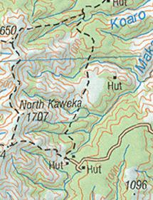
Similar Threads
-
garmin 62s
By nork1122 in forum Gear and EquipmentReplies: 9Last Post: 15-07-2013, 04:08 PM -
garmin 62s, which sd card?
By foxhound in forum Gear and EquipmentReplies: 0Last Post: 09-03-2013, 06:19 PM
Tags for this Thread
- 260,
- 300,
- 5000,
- accurate,
- adventure,
- atlas,
- ballistics,
- bucks,
- buy,
- camera,
- canopy,
- case,
- cheap,
- coast,
- day trip,
- deer,
- device,
- farmer,
- garmin,
- gear,
- gps,
- handheld,
- information,
- iphone,
- kawekas,
- legend,
- loads,
- lost,
- maps,
- offline,
- pack,
- packs,
- pants,
- permits,
- phone,
- plb,
- r93,
- radio,
- rangefinder,
- ranger,
- ranges,
- receiver,
- rino,
- rust,
- satellite,
- sony,
- south island,
- tents,
- test,
- top,
- topo maps,
- trip,
- turn,
- usa,
- water proof,
- waterproof,
- west coast
 Posting Permissions
- You may not post new threads
- You may not post replies
- You may not post attachments
- You may not edit your posts
Welcome to NZ Hunting and Shooting Forums! We see you're new here, or arn't logged in. Create an account, and Login for full access including our FREE BUY and SELL section Register NOW!!
All times are GMT +13. The time now is 11:54 PM.

Bookmarks