

 10Likes
 LinkBack URL
 About LinkBacks
First, I must apologise as these are from a cheap home slide scanner on 35 yo 35mm slides.
In this country, it's all about "conditions". When you get there it might be totally different. This was February 1987, a week after the last snow.
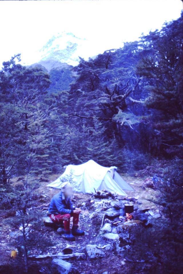
Here's the campsite at Elcho Forks.
I guess we were only there in the evening/early morning.
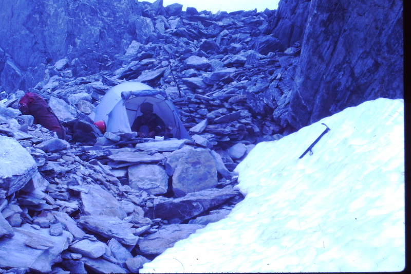
Here's the campsite at Elcho Pass.
There was a rock wall as high as the tent, built up by people who had stayed there. The water supply is handy but needs melting.
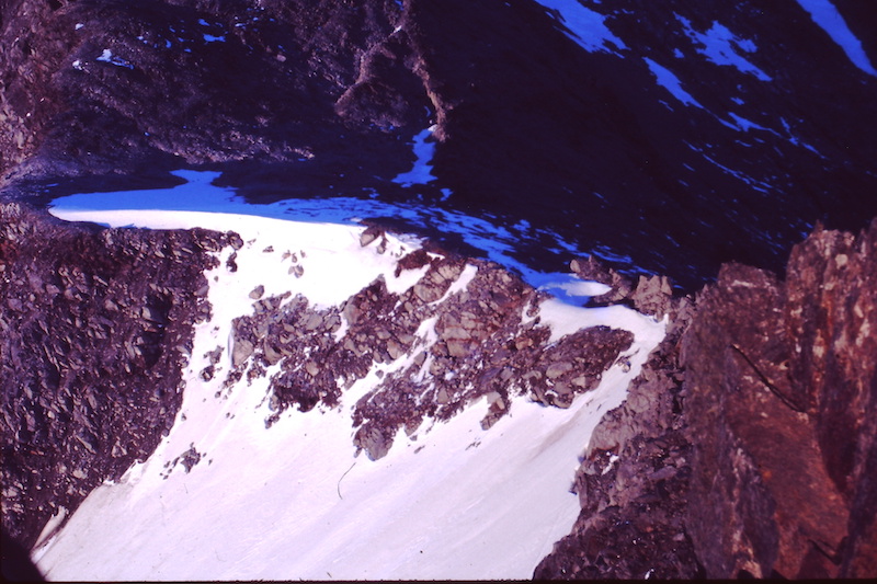
This is the Western (Landsborough/Kea Ck) side of Elcho Pass.
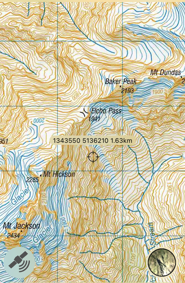
Topo50 screenshot of the map.
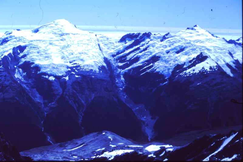
For some reason, I didn't get many photos looking down onto Kea & McKerrow creeks but here is one looking across the Landsborough to Dechen and Strachan peaks.
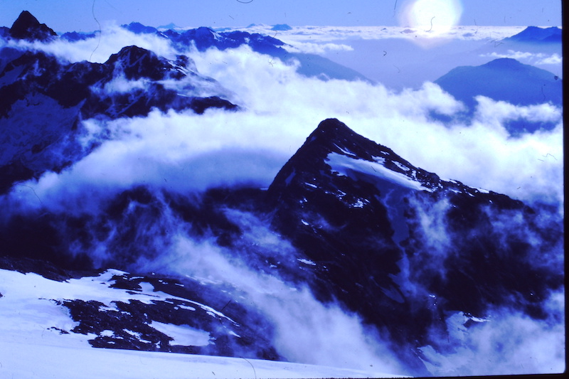
Just a scenic shot showing a fine weather evening, with Mt Jackson on left on the skyline, Mt Hickson is the rounded peak and Baker Peak is the triangular peak in the centre. The bar of mist flowing across the divide is going over Elcho Pass.
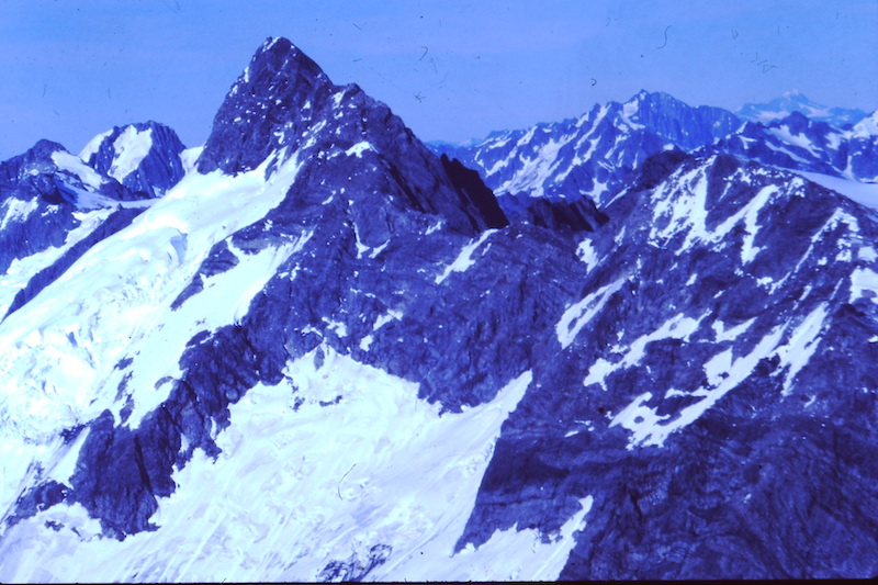
Here is a similar view with more detail showing Mt Jackson and Mt Hickson. The low point is not Elcho Pass. You have to make sure you're climbing up the correct gully/face to get to the pass.
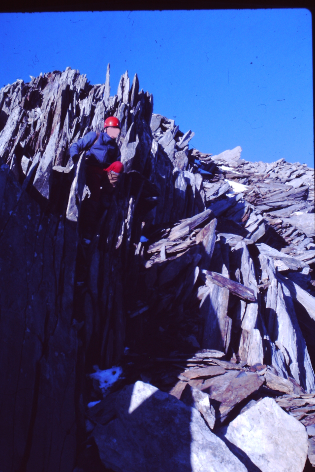
This is typical travel on the main divide here; frost shattered rock.
Welcome guest, is this your first visit? Create Account now to join.
Welcome to the NZ Hunting and Shooting Forums.
Search Forums


User Tag List
+ Reply to Thread
Results 1 to 6 of 6
Thread: Elcho Pass
Hybrid View
-
27-12-2021, 11:15 AM #1Member

- Join Date
- Mar 2012
- Location
- Waikato
- Posts
- 2,189
Last edited by Bagheera; 27-12-2021 at 11:21 AM.


 Reply With Quote
Similar Threads
-
It's a PASS!
By Matt-j in forum Firearm SafetyReplies: 14Last Post: 14-12-2016, 01:06 PM -
lewis pass?
By 223nut in forum HuntingReplies: 3Last Post: 08-05-2016, 10:34 AM -
Weekend pass
By petree in forum HuntingReplies: 10Last Post: 13-04-2014, 09:55 PM -
Dennistoun Pass
By phillipgr in forum Other outdoors, sports, huts and tracksReplies: 0Last Post: 25-12-2013, 02:05 PM
Tags for this Thread
 Posting Permissions
- You may not post new threads
- You may not post replies
- You may not post attachments
- You may not edit your posts
Welcome to NZ Hunting and Shooting Forums! We see you're new here, or arn't logged in. Create an account, and Login for full access including our FREE BUY and SELL section Register NOW!!
All times are GMT +13. The time now is 08:04 PM.

Bookmarks