When I look at contours on Google Earth, the coordinates do not match my new maps. I assume they are using the old system. Do I need to delete GEarth and reinstall, or am I missing something?
Printable View
When I look at contours on Google Earth, the coordinates do not match my new maps. I assume they are using the old system. Do I need to delete GEarth and reinstall, or am I missing something?
I think it depends on what you are comparing to. Google earth will be projected using a slightly different format than say, Linz.
I am not a techy by any means, but I do know that positions will be given on GE in a format that may not match what ever mapping you are using.
There are simple (ish) ways of converting though
Do you mean a different coordinate system, as in decimal degrees vs degrees minutes seconds vs UTMs.
Might just need to select a different format on the google earth
UTM on google earth still wont match NZTM though, will it?
Pass, hopefully someone here is into GIS.
Google earth only has a few preset coordinate options.
Nope, different projections.Quote:
Originally Posted by Pengy
Bugger.
All this has gone over my head, will WAMS not do what you are after?
Quote:
Originally Posted by moonhunt
YEP
WAMS it is then :thumbsup:
If you want to use a GPS unit with google earth try setting the GPS to WGS84 coordinates, should be the same as google earth. Or just use something else like WAMS, like other people have said.
Are the new maps digital or old school folding type Lentil?
If they're digital and on a GPS, I agree the easiest would be to reset the GPS datum to match Google Earth, I had figured they were paper maps though.
NZTopo is a site i find good for getting GPS co-ords. Just remember to press the convert button to select your preference of nav setup if that makes sense?
WAMS all the way for me, as I like to toggle between the topo map and ariel pics. Much more accurate way of marking spots that just having topo alone.
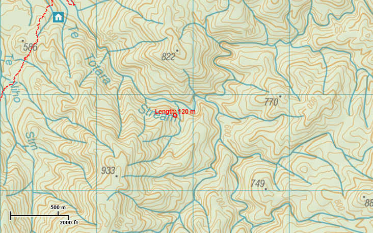
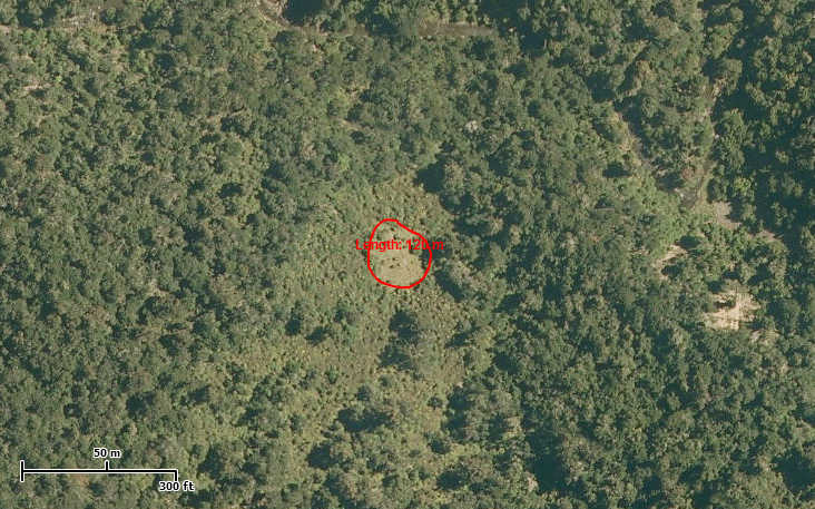
Attachment 21804
Can you see the little grassy clearing
Attachment 21805
Ariel shot taken by simply toggling on WAMS
NZTopo does the same Pengy ;)
It does to a degree Rusky, but NZtopo doesnt have the same zoom capabilities , and the ariel pics are dont look anything like as clear to my old eyes.
Can you do the DOC boundary overlay on Topo ? I cant see it
I cant find a way to mark tracks on NZ topo either, or save a screenshot, and even marking a spot seems longwinded. Nah, I will stick with WAMS
Ok you win Pengy. Ill have to try use WAMS. DoC boundary line is something id love to know ho to do.
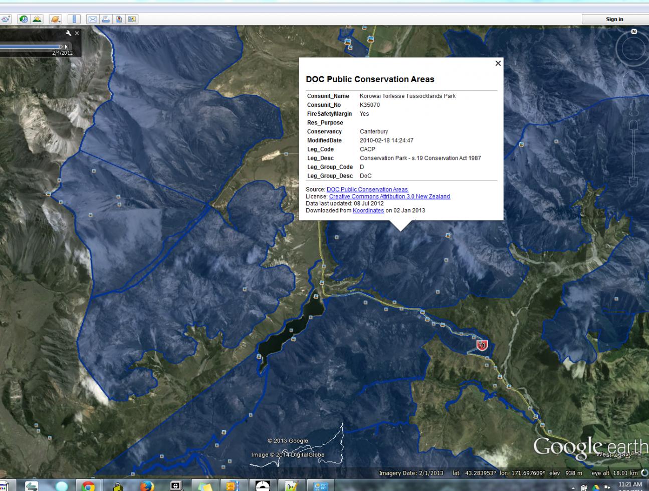
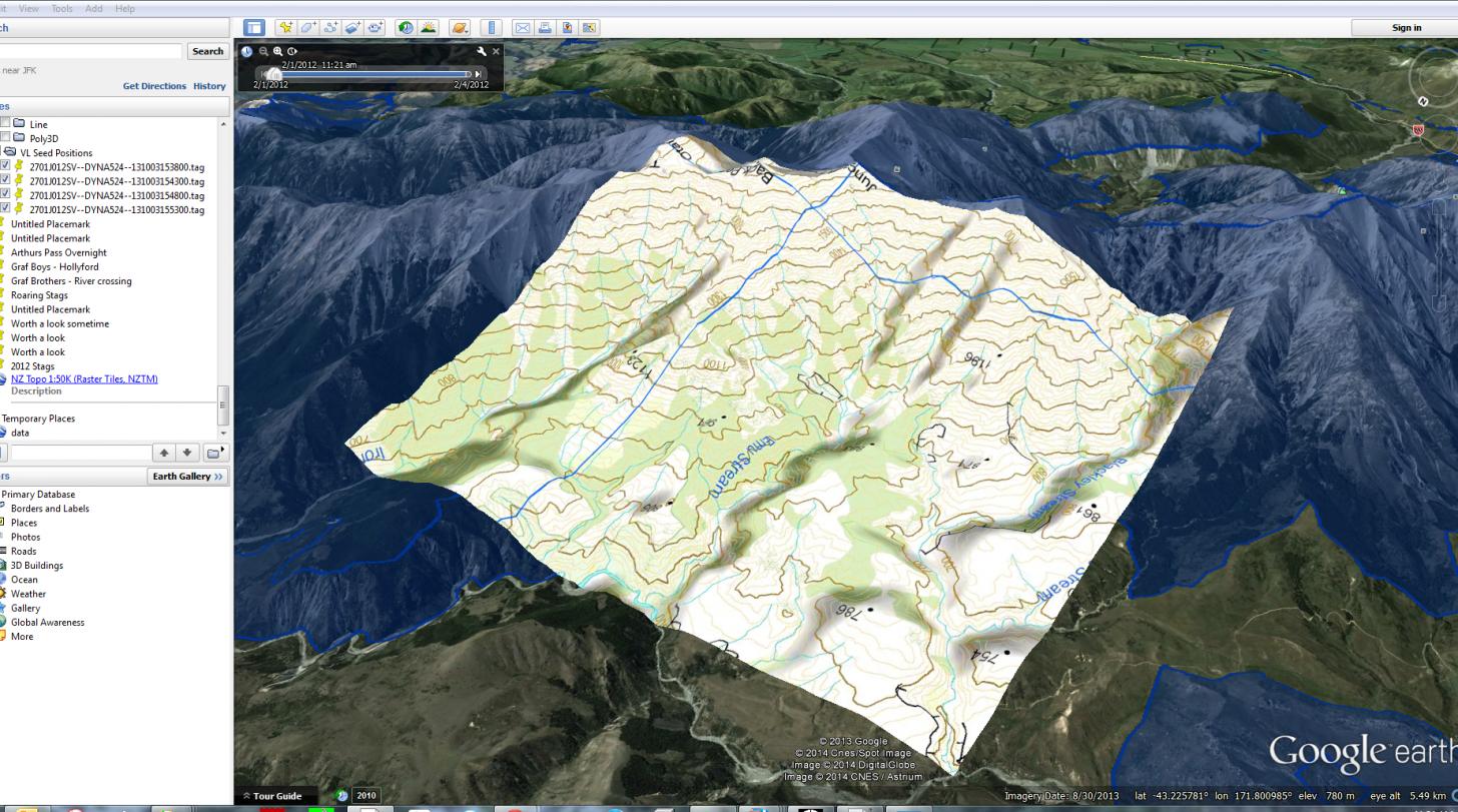
Goggle Earth uses WGS-84 or UTM (Universal Tranverse Mercator). NZTM (or the latest Topo map) is quite different, but can be converted (very painfull for hunting etc). I'm not a GIS expert, but do test and provide GPS/GNSS support fro Surveyors and contractors all over the world.
There is many ways to get what you what; set your GPS to WGS-84 and then Goggle Earth positions will work easy. Or, import the Topo maps and Doc boundaries to Goggle Earth. Looks like this:
Attachment 21821
Are with the Topo layer too:
Attachment 21822
This data comes from the Koordinates.com site and then exporting the layers as .KML/.KMZ file. These can also be loaded in Apps like Backcountry Navigator (what I use) and the newer Garmin and a few others.
This is the same area with DOC boundaries in Backcountry Navigator (on Android devices only)
Attachment 21823
Correct, the NZGD1949 was not WGS84, but Google Earth using WGS84. The new system is NZTM200, similar(not the same though) to the UTM system that can be used all over the world. Positions can be converted on the Linz site here Convert coordinates between NZ coordinate systemsQuote:
Originally Posted by Tussock
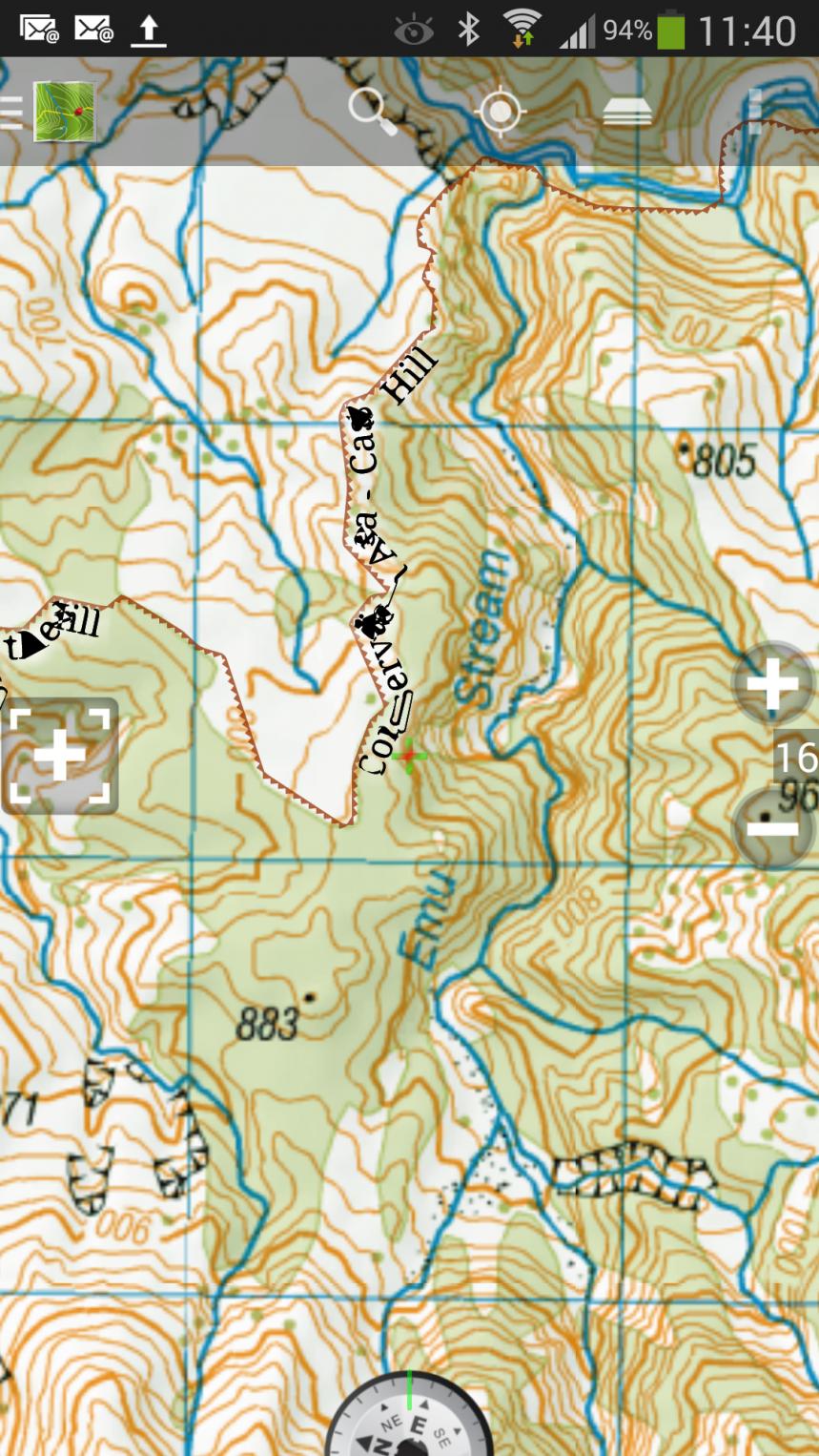
Converting NZTM to UTM for Emu Stream in the picture above, not the same coordinates:
NZTM ------------------- UTM zone 58 (south)
Northing Easting --- Northing Easting
5214802.0 1505884.0 -- 5192678.2 1055768.9
WAMS is really good for view that areas, I do use it a lot. However, it does rely on an internet connection. Having the exported .KML files on the GPS is real handy.
Should be a scale factory too.Quote:
Originally Posted by Tussock
Stuff all that flapping around. I am just going to buy Maptoaster which has ariels as well as DOC boundaries etc. :thumbsup:
WTF :wtfsmilie: :wtfsmilie:Quote:
Originally Posted by Pengy
But only when I can afford it. Freshmap is 2008 version, so a bit out of date now. I will keep the computer based version as I like it for planning trips.Quote:
Originally Posted by Kaweka_Neil
This shit is technical man. Im still Goggling the first post so I can work out what it all means :nose bleed:
Looked at WAMS and that is just what I was after. Found the coordinates of that clearing I spotted at......... Cheers guys.Quote:
Originally Posted by Pengy
I wish I had the know how to load this to my gps http://maps.doc.govt.nz/Viewer/Index.html?viewer=rwa
satellite/topo huts tracks and doc plus doc hunting.
Nothing is impossible. With time and money, you can just about do anything!Quote:
Originally Posted by oneipete
What make and model is your GPS?
I was a bit disapointed with that DOC mapping website. It runs slow, and the ariels are poor quality comapared to others. Shame really, as they have had the likes of WAMS as a yard stick.
I have contacted the guys at Wams on a few occasions when their server has had issues, and found them to be very helpfull and freindly.
What kind of support do you have in mind Tussock?
Naturally they are "old school" like me.Quote:
Originally Posted by Moutere