-
1 Attachment(s)
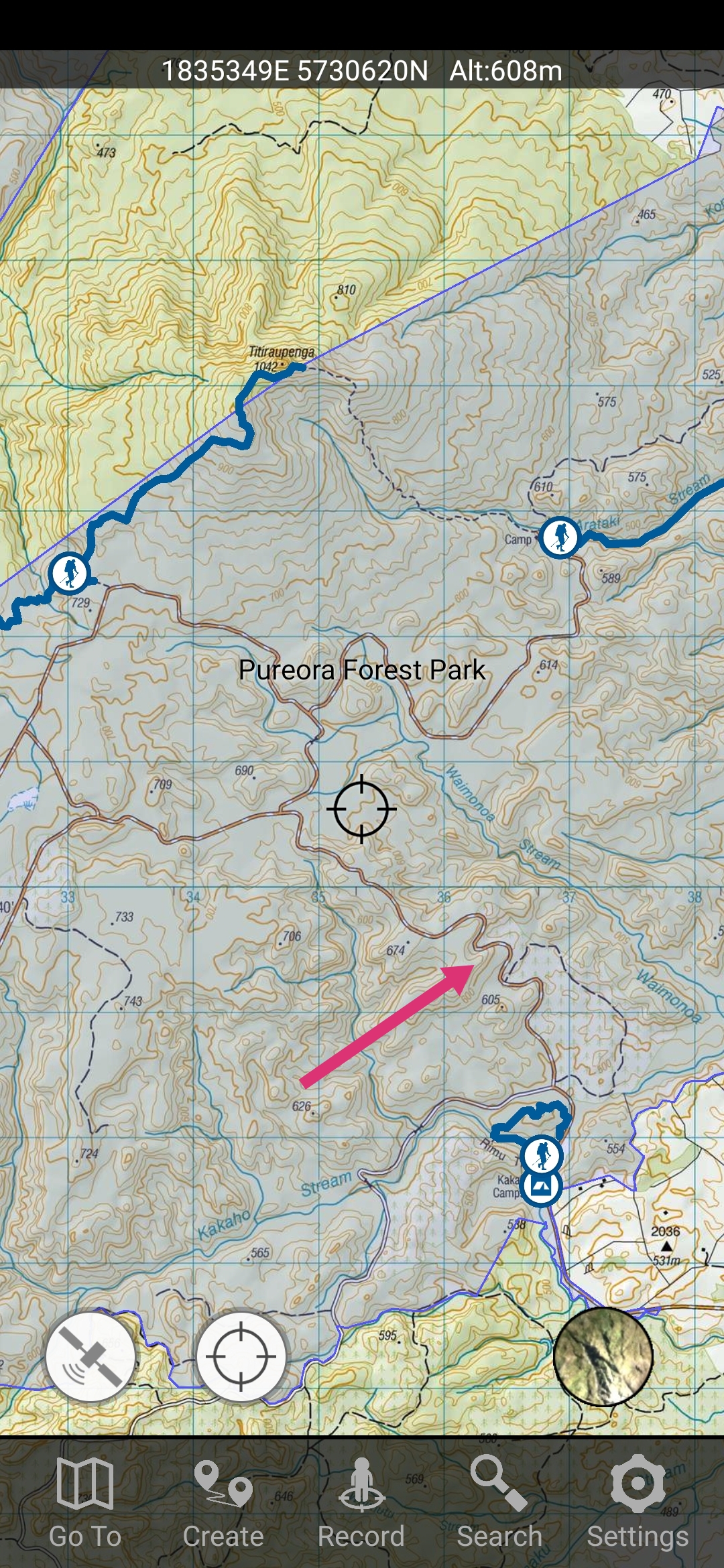
Kakaho Rd Pureora
Hi team, looking for info on the state of this road these days. I understand the access to Bogg Inn in closed now, I'm wondering how it is further on towards "the centre of the North Island". How far can you get along here in a four wheel drive? I drove to the intersection where you would of turned left to head to Bogg Inn today, but didn't carry on any further as it was getting dark. Haven't been up here in like 10 years so any info is appreciated.
Attachment 178831
-
That looks like Link road where you want to go. Instead of turning left to go down bog inn road, you carry on straight. That will take you all the way to the other side. The center of the North Island is off there.
-
Its all still do-able in a 4WD vehicle in 2WD. The not so odd tree will be down on the road, but guys saw/pull them out of the way pretty quick. I believe you can still access the bog inn track, but the sign at the Supertanker gate mooring says walking only. Fucked if I know how that works. WAMS showed all that land as DOC administered, then about a year ago I saw it wasn't green any more. So no longer administered by DOC. Must have been used in a treaty settlement???
-
Can you pretty much drive through to Pueora/Barryville? That would be pretty cool. I live pretty close to Kakoho road now so after work missions in summer could be on the cards. Guess the area gets hammered pretty hard animal wise with such easy access?
-
Yup. ��. Heaps of cool places to explore in there.
-
Great places there, BUT anywhere you can drive to gets 'bonnet" hunted daily, even though it's not meant to be happening at Cindy's level 2.
-
Go for a drive Kakaho through to Pureora is used by cars.
Centre of the North Island the same.
You can also carry on from CNI to the YMCA camp.
As said bonnet hunted but park up and walk.
-
Yup, park up and walk was my plan. Just neat to know I can cover that much ground quickly to check places out.