

 8Likes
 LinkBack URL
 About LinkBacks
Hi, has anyone done this before, wondering if there is a website/app that allows me to upload the routes I've walked in the bush onto a topographic map and print them out? I know you can upload to google earth, but would prefer a topographic map,
Cheers ben
Welcome guest, is this your first visit? Create Account now to join.
Welcome to the NZ Hunting and Shooting Forums.
Search Forums


User Tag List
+ Reply to Thread
Results 1 to 7 of 7
Thread: Making maps
Hybrid View
-
30-06-2015, 11:40 PM #1Member

- Join Date
- Jun 2015
- Posts
- 37
Making maps
-
01-07-2015, 12:59 AM #2Member

- Join Date
- Sep 2012
- Location
- Up in da hills somewhere near Nelson
- Posts
- 9,811
Freshmap is great for this, and more besides. Maptoaster also works, but I find it slow and not as user friendly.
Forgotmaboltagain+1
-
01-07-2015, 01:18 AM #3Member

- Join Date
- Sep 2014
- Location
- Clarks Beach, (South of) Auckland
- Posts
- 1,739
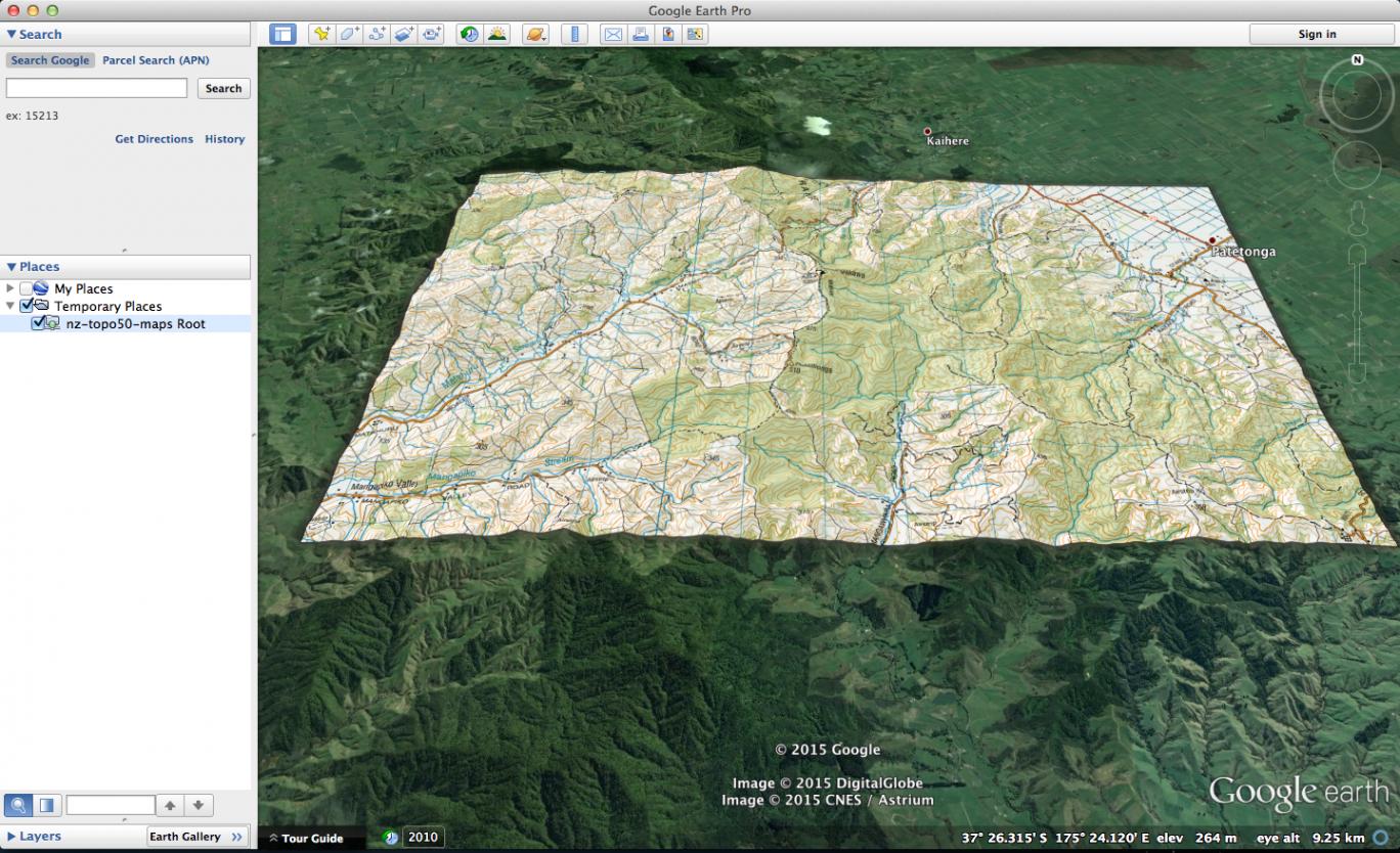
Google Earth PRO supports GeoTIFF files. GeoTIFF files are images with all the georeferencing coordinate info built in.
1. Download Google Earth Pro from here. It's free now. When installing, licence key/password is any email, and 'GEPFREE'.
2. Go to https://data.linz.govt.nz/ and create a login.
3. Go to https://data.linz.govt.nz/layer/767-nz-topo50-maps/, and click on the orange/yellow '+' sign in the top left to add it to the map. Use the crop and download buttons in the top right to dowload your area of interest. Select TIFF as the download format.
4. Unzip the resulting file into a folder with a bunch of files.
5. Open Google Earth Pro and use File/Open to open the 'nz-topo50-maps.tif' file. Google Earth Pro will zoom to that area, and you'll see the topomap overlaid. If you get a pop-up appear about cropping or scaling or super-overlay, just choose one. I chose Super-overlay, and it worked fine.
6. Add your GPX file(s) to Google Earth the normal way.
7. Send 7.62x39 SP ammo my way so I can get more goats
-
01-07-2015, 10:35 AM #4Codswallop

- Join Date
- Feb 2013
- Location
- The Hill
- Posts
- 23,584
That's way harder than the google earth standard? that I have installed. Open google earth, go to topo and download KMZ, it automatically puts it into google earth....just need to move it from temp file to my places. Originally Posted by stretch
 Pengy likes this.
-
01-07-2015, 10:04 AM #5Member
- Join Date
- Sep 2012
- Location
- Up in da hills somewhere near Nelson
- Posts
- 9,811
Wams site also works for this of course, and you can toggle between topo and satellite. Very easy to use.
Forgotmaboltagain+1
-
01-07-2015, 10:35 AM #6Codswallop
- Join Date
- Feb 2013
- Location
- The Hill
- Posts
- 23,584
Stop waming on about it Originally Posted by Pengy
 BRADS likes this.
-
01-07-2015, 10:10 AM #7Member

- Join Date
- Jul 2014
- Location
- South Island
- Posts
- 498
Handy


 Reply With Quote
Similar Threads
-
Maps
By Full noise in forum Firearms, Optics and AccessoriesReplies: 2Last Post: 15-03-2015, 11:03 PM -
topo maps
By Dynastar27 in forum Gear and EquipmentReplies: 29Last Post: 06-04-2014, 11:15 PM -
Maps For an iphone
By camo wsm in forum Gear and EquipmentReplies: 5Last Post: 31-12-2012, 12:28 AM -
Which GPS with topo maps?
By Tikka7mm08 in forum Gear and EquipmentReplies: 11Last Post: 13-04-2012, 11:20 AM
Tags for this Thread
 Posting Permissions
- You may not post new threads
- You may not post replies
- You may not post attachments
- You may not edit your posts
Welcome to NZ Hunting and Shooting Forums! We see you're new here, or arn't logged in. Create an account, and Login for full access including our FREE BUY and SELL section Register NOW!!
All times are GMT +13. The time now is 12:01 AM.

Bookmarks