Gidday, can someone give me a idea on the travel time from Thompsons Track junction (from waikato side) to Motutapere Hut ? and any pointers on directions and the hut in general. Plan on going for a looksey :) thanks in advance..
Printable View
Gidday, can someone give me a idea on the travel time from Thompsons Track junction (from waikato side) to Motutapere Hut ? and any pointers on directions and the hut in general. Plan on going for a looksey :) thanks in advance..
Not sure, I've never walked it but usually they have the track times on the doc website. If not, try the rule of 20mins/km and at 3min for every contour up and 1min for every contour down. If you can be arsed haha. Bare in mind it can change a lot when you're off-track.Quote:
Originally Posted by Shaneo
Sent from my MT27i using Tapatalk 2
I can't remember track times, but I do know that if you turn left at what is known as the cross roads on Thompsons Track and make your way to the North/South Track on what is known as the "Hundred Acres" you can save yourself some time by missing the first uphill slog from the Junction. You can also get to the hut or return via Tuahu Track or there is a track from above the Killarney Lakes that will bring you out just South of the hut.
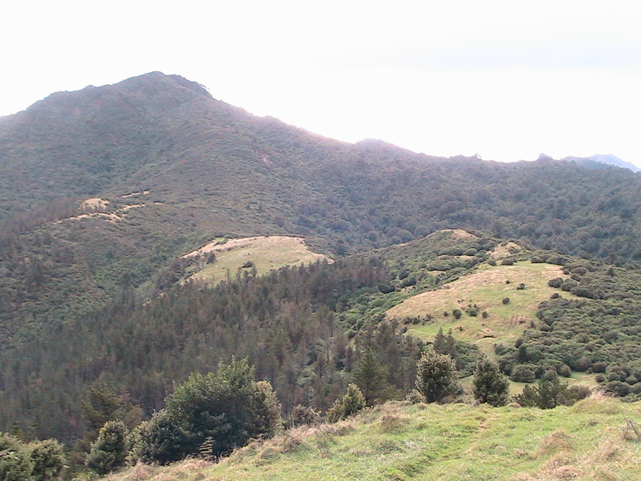
This photo is taken from close to where the North/South Track enters the bush on the southern side of Mt. Motutapere. Looking south, if you come in from the Junction you will come onto the grass at the distant grass. If you come in from the Crossroads you will be at about centre right of photo and make your way to where photo was taken along right hand side of picture. North/South track follows approx grass/bush edge on left and centre of photo.
Attachment 10760
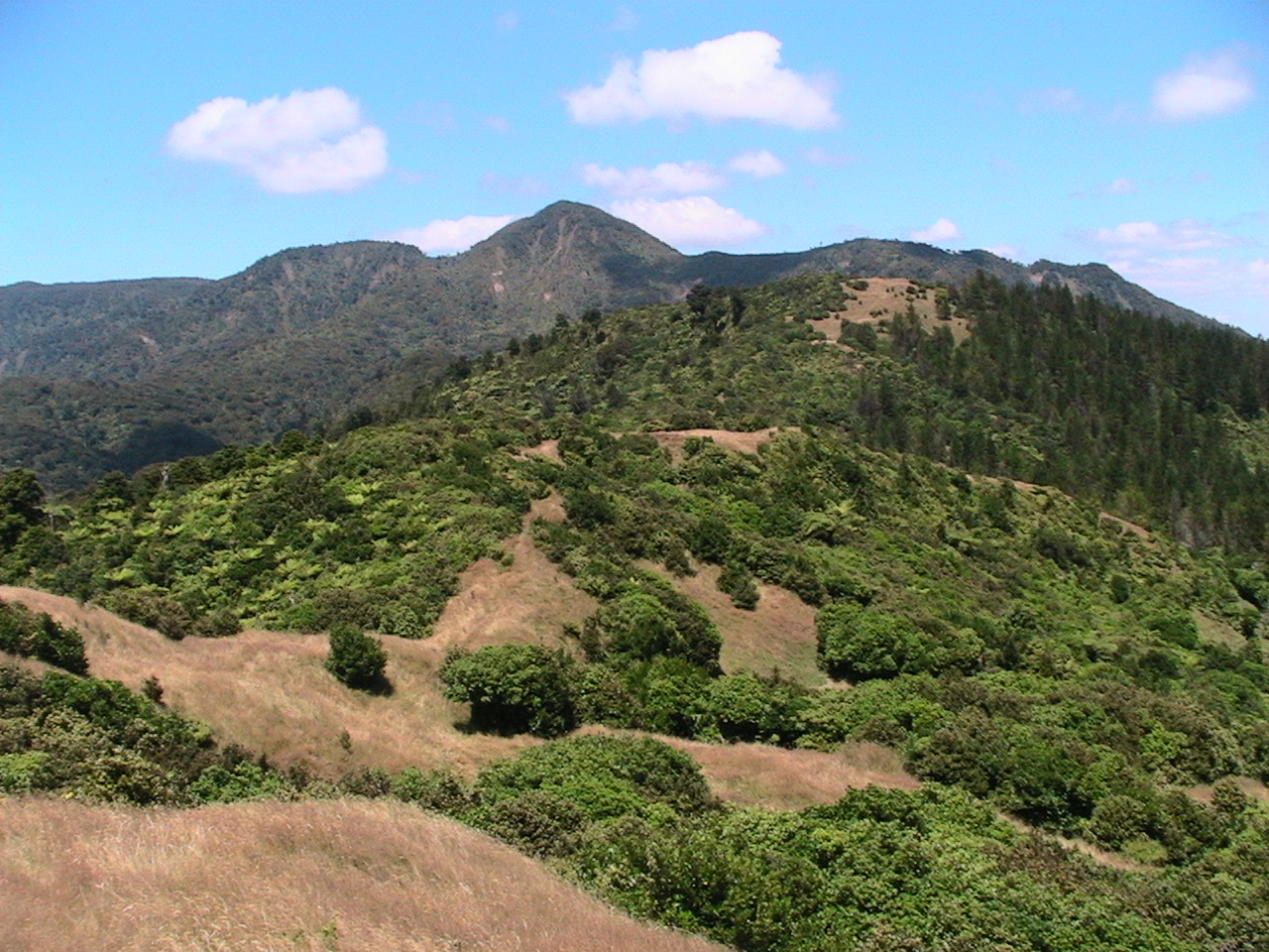
This photo shows the "Hundred Acres" and Mt.Motutapere as you would see it when coming from the south [Junction]. You will leave the grass and enter bush off the right top corner of grass area in photo centre. Hut is somewhere out to the right of photo near skyline.
Attachment 10761
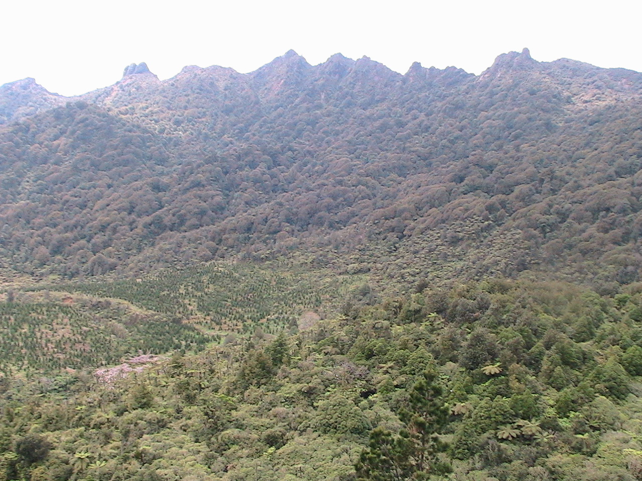
This photo shows the country north of the hut which is somewhere in the right of picture. This photo is a couple of years old and pines are now taller. Tuahu track is on far side and above clearing...the puddles of water are the Killarney Lakes. The other track I mentioned earlier is on one of the ridges centre right.
Attachment 10762
Spook mate you are a legend, pretty much the way I was thinking of going (over the grass acres) will def have to keep to my promise of a beer session
I seen your car there last time...kept an eye out for you...you either put in an honest days hunting, or were lost:PQuote:
Originally Posted by Shaneo
Oops wrong photo...Killarney Lakes are out of picture on leftQuote:
Originally Posted by Spook
haha not lost bro just in the zone. Hunted the first and second cut overs then went bush up to those massive 4x4 ruts at the ridge top. Good areas but not much sign, keen to get to know the area well hence the rekky to the hut soon.