

 38Likes
 LinkBack URL
 About LinkBacks
Yes - you are 100% right. However what often looks like Queens chain on a cadastral map can also be either Road reserve (the so called paper road) or Esplanade Reserve. The interesting thing about esplanade reserve is that it DOES move with the river.Originally Posted by LBD

Welcome guest, is this your first visit? Create Account now to join.
Welcome to the NZ Hunting and Shooting Forums.
Search Forums


User Tag List
+ Reply to Thread
Results 16 to 30 of 31
Thread: Queens chain
-
19-04-2021, 07:19 PM #16Member

- Join Date
- Jul 2012
- Location
- Invervegas
- Posts
- 4,555
Moa Hunter likes this.
-
-
19-04-2021, 07:33 PM #17Member

- Join Date
- Oct 2012
- Location
- nelson
- Posts
- 1,144
Wrong........walking access doesnt mean you cant carry rifles, rods or whatever. Same with a dog if its controled, ie on a lead and stays in the :Queens chain". Originally Posted by DavidGunn
Being able to use them while there is a totally different question but getting from point a to point b to hunt etc is ok. Clearly such situations you want to be talking to any landowners your intentions
and what and where you want to go etc. Years ago i used to hunt pigs with my mate and his dogs. There was a landowner who didnt like pighunters etc and wouldnt give permission to cross there land to get to DOC.
We walked up the Queens Chain for the 30mins and hunted. Dont thibk they really liked the fact but as long as we didnt go on their property they couldnt do much about it and did that for yearsLast edited by deer243; 19-04-2021 at 07:39 PM.
Moa Hunter and Micky Duck like this.
-
19-04-2021, 07:59 PM #18Member
- Join Date
- Jan 2015
- Location
- Waikato
- Posts
- 2,172
I don't mind too much about being told I am wrong but information was from beehive.govt.nz site...tell them they are wrong and let us know how you got on...cheers Originally Posted by deer243
https://www.beehive.govt.nz/release/...ns-and-answers
-
19-04-2021, 11:03 PM #19Member
- Join Date
- Oct 2012
- Location
- nelson
- Posts
- 1,144
You know that press release is dated 2004. Secondly the whole point of having a so called Queens chain is allowing access to public land, bush, rivers, lakes etc for the public to enjoy there rec activities Originally Posted by DavidGunn
without being blocked by private landowners.
So to access the public land to hunt, fish etc clearly you allowed to take a firearm, rod or dog as if not you couldnt do the Rec activities on public land that they have allowed access to from having a queens chain .
Plus, i also state that the police confirmed at the time to my mate that walking the river bed thru the queens chain on that farm to hunt the DOC land was fine as long as
we didnt step foot on the private land .....of cause that means taking rifles, dogs was perfectly fine as thats what you needed to hunt the pigs.
So maybe show us something that states you cant thats updated and just doesnt mean in the queens chain but accessing Doc thru itMoa Hunter likes this.
-
20-04-2021, 05:52 AM #20Member
- Join Date
- Jan 2015
- Location
- Waikato
- Posts
- 2,172
The Queen has been around since 1953, so something dated 2004 is relevant...and I would be dubious about the word of one policeman, unless he/she gave it in writing. Originally Posted by deer243
-
20-04-2021, 08:38 AM #21Member
- Join Date
- Oct 2012
- Location
- nelson
- Posts
- 1,144
Well, if you making your decisions on 17 year old statements and cant see clearly the point i was making thats up to you. I say again, the Queens Chain is for the purpose is it not to allow access
to puclic land that otherwise may not be able to access if blocked by landowners. The purpose to get access to this land is to do REC activities which the biggest percentage would be to hunt and fish.
To hunt you need rifles etc so do you really believe you cant carry a rifle thur queens chain to get to DOC land where you hunting.
Makes totally no sence at all and people have been doing it for years so your agruement saying otherwise is pretty ilrelevant esp as you got nothing to back it up and quoting someting from 17 years ago
doesnt mean its still the facts and actuaaly what it means in real terms how you read iterniec likes this.
-
20-04-2021, 10:35 AM #22Member
- Join Date
- Feb 2018
- Location
- North Island
- Posts
- 144
Hi Folks, friendly licensed cadastral surveyor here.....
So the queens chain is a colloquial term for a collection of devices that allow for public access along SOME rivers, streams, lakes and coastline. (Side note - a 'chain' is what was used by early surveyors to measure distances, one "link" in the chain is 0.201168 m. A whole chain was 100 links long or near on 20m.)
I say some as just because there is a river there it doesn't mean that anything has been set aside along that river for public access. Some titles go to the middle of the river regardless of if it moves or not (known as ad medium filum aquae), some don't. Some boundaries go to mean high water springs or the top of the river bank.
There are generally four devices that allow for public access along a river/lake/coast.
A Marginal Strip
These are strips of land usually 20m wide that have been set aside under the Conservation Act, DOC administers these and the don't move regardless of if the rivers moves.
A Moveable Marginal Strip
Same as above but may be a different specified width and do move if the river bank/coastline moves
An Esplanade Reserve
An esplanade reserve is the modern version of a Marginal Strip except it is owned and administered by the local council (TA) These also don't move and sometimes do have conditions as to what can be done on them (ie carrying a firearm, dogs, lighting fires etc)
An Esplanade Strip
An esplanade strip is the modern version of a moveable marginal strip. The land owner retains ownership of the strip and it is essentially a "right of way" for public to cross over. These do move and are set off the current location of the top of river bank regardless of what has been recorded on the survey plan or in WAMS. Sometimes these can be less than 20m depending on what has been negotiated with the council when it was created. These sometimes also have conditions of use attributed to them.
Clear as mud aye?
Paper roads are different again, these have been surveyed and pegged and don't move. They are "owned" by the local council and everyone has a right to pass over them unless it has been temporarily closed for Health and Safety. This often happens during logging. They have the same legal standing as the street in front of your house, a land owner can't legally stop you from passing over the paper road regardless of whether they are occupying it or not. They don't own it or pay rates on it. Does it mean that you can wander along a paper road through someone's farm without their permission? Legally if you stay on the paper road yes. But there are a couple of problems.......
It can be very difficult however for a lay person to be sure of where the legal road lies. Survey plans were digitized into the current online system (Landonline) and are reasonably accurately shown on GIS maps that most councils and WAMS have if they are close to town where there is constant survey work. Once you get out of town the GIS maps can be way off.
You are walking into someone's back yard and just because you can legally walk up a paper road doesn't mean you should. Some areas have had disputes with landowners and have been settled through doc or council intervention and the paper road has been marked.
Sometimes a paper road runs alongside a river/stream or coast as well.
-
20-04-2021, 10:53 AM #23Member

- Join Date
- Apr 2015
- Location
- UK
- Posts
- 7,903
If you are carrying a firearm without permission of the landowner is this not aggravated trespass?
It's all fun and games till Darthvader comes along
I respect your beliefs but don't impose them on me.
-
20-04-2021, 11:01 AM #24Member
- Join Date
- Feb 2018
- Location
- North Island
- Posts
- 144
Aggravated trespass is a UK thing I think and relates more to being on someone's land and obstructing them in some way. Possibly more directed at protestors? Originally Posted by Sideshow
-
20-04-2021, 11:05 AM #25Member
- Join Date
- Apr 2015
- Location
- UK
- Posts
- 7,903
Yes UK not sure if it also in NZ. So if I walk through your back garden in the uk that’s trespass. If I carry a shotgun that’s the Aggravated trespass. Originally Posted by kickinwings
It's all fun and games till Darthvader comes along
I respect your beliefs but don't impose them on me.
-
20-04-2021, 12:22 PM #26Member
- Join Date
- Jan 2015
- Location
- Waikato
- Posts
- 2,172
Find and show your theory by legislation....just because my link is 17 years old does not make it invalid. Originally Posted by deer243
Grasshoppa likes this.
-
20-04-2021, 12:49 PM #27Member

- Join Date
- Jun 2015
- Location
- Murchison
- Posts
- 762
And you are also correct... in our case the river went through the Queens Chain and the Paper road.. both which are now well out into the river. Originally Posted by Tentman
On the use of a queens chain... my understanding is that it was created for fishing access...?
-
20-04-2021, 07:50 PM #28Member
- Join Date
- May 2015
- Location
- NZ
- Posts
- 579
Thanks for your contribution @Kickinwings....always useful to hear from someone who knows what they're on about. Originally Posted by kickinwings
Couple of questions, though.....
Where do the 'loggers' get their authority to restrict access across a paper road while they're logging? While that may be a convenient and practical solution, my understanding is that a paper road is no different to a formed and maintained TLA road?
And with respect to someone wandering along a paper road, I'd have expected the onus was on the adjoining landowner to establish a trespass had occurred, rather than the pedestrian being required to establish that he/she had remained on the alignment?Husky1600 likes this.
-
21-04-2021, 11:15 AM #29Member
- Join Date
- Feb 2018
- Location
- North Island
- Posts
- 144
Logging companies can apply to the council to have roads temporarily closed. Anyone can apply to have a road temporarily closed for that matter and if the reason is good enough the council will grant it. They do it all the time for cycle races and other events in town. Originally Posted by Maxx
As for wandering along a paper road you are probably correct. I've never actually heard of anyone getting prosecuted or trespassed in this way and it comes down to intent I suppose. If you were doing your best to stay on the paper road with GPS or your phone I'd say you would be hard pressed to get into trouble. But if the farmer then says hey you're on my property I guess its up to you to prove that you are not?
It usually comes to head when lots of people try to access somewhere via paper road (a doc block or beach) and the land owner gets niggly, usually due to people disrespecting the property or being a pain in the arse in some way. Although sometimes landowners just plain don't want people "on" or near their property which is fair enough but if there is a paper road through it then they have no choice but to allow access along it as it's not their land. In these cases the council or DOC usually pay for the paper road to be surveyed and ground marked.
Another issue regarding vehicle access is that often the physical road you drive on and the legal paper road isn't in the same place on the ground. The original surveyors who did the surveys in the late 1800's early 1900's and were just trying their best to pick a good route to a spot through the bush. When the road actually gets built it might have been easier to take a different route. Which sometimes leads to the case where the landowner can put a locked gate over the road as the physical road is actually on his land and not the paper road.Micky Duck likes this.
-
26-04-2021, 04:34 PM #30Member
- Join Date
- May 2016
- Location
- CHCH
- Posts
- 326
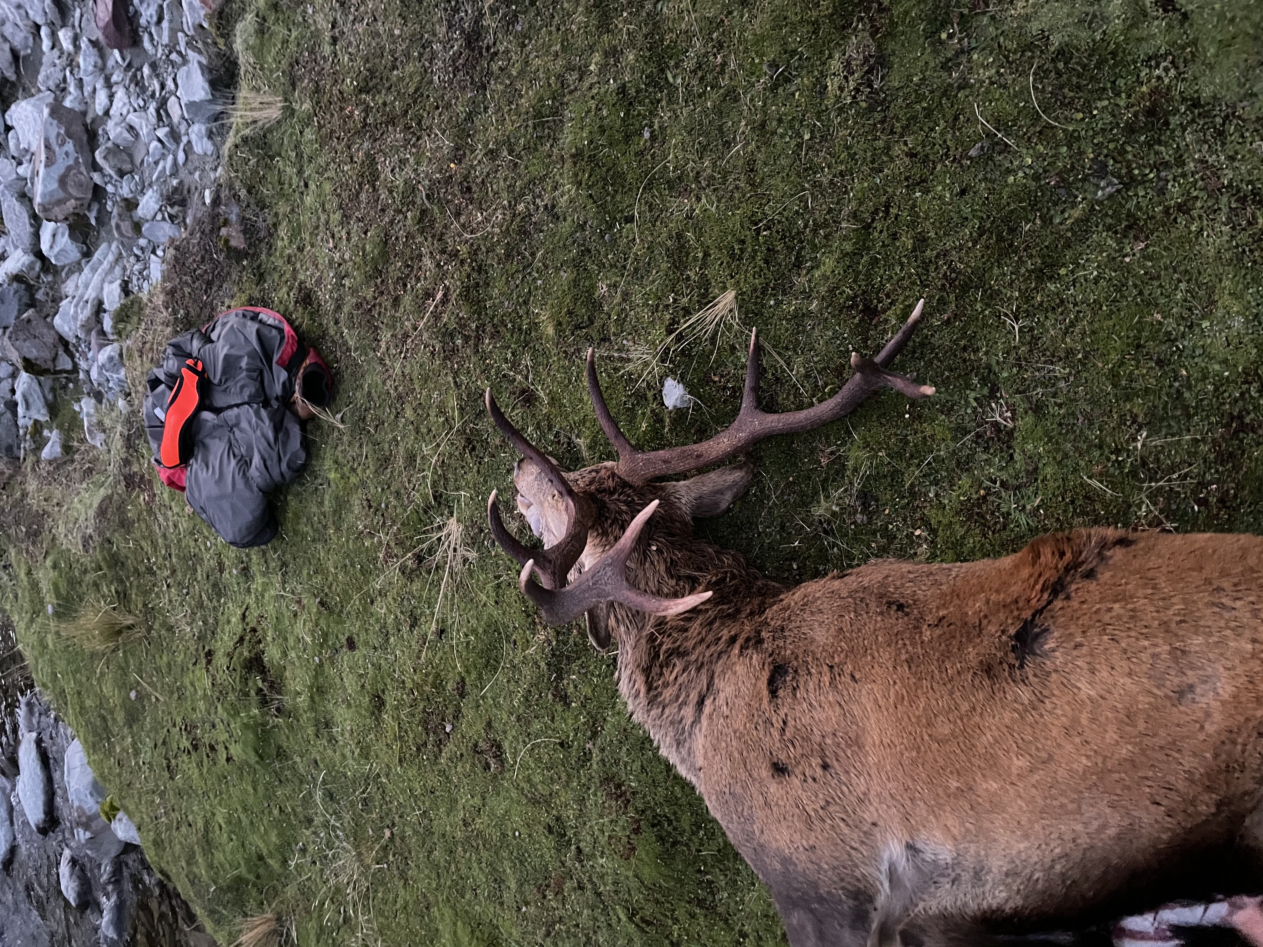
End result was a stag shot 200m from camp well into public land ��
 Husky1600 likes this.


 Reply With Quote
Similar Threads
-
Food chain
By linyera in forum TaxidermyReplies: 1Last Post: 17-02-2016, 09:59 AM -
My Queens Birthday
By EeeBees in forum Game Bird HuntingReplies: 15Last Post: 04-06-2013, 10:37 PM
Tags for this Thread
 Posting Permissions
- You may not post new threads
- You may not post replies
- You may not post attachments
- You may not edit your posts
Welcome to NZ Hunting and Shooting Forums! We see you're new here, or arn't logged in. Create an account, and Login for full access including our FREE BUY and SELL section Register NOW!!
All times are GMT +13. The time now is 01:29 AM.

Bookmarks