You will need a converter like GPSBabel. The KML file is what Google will use, the GPX file is what you want and it is an open source file that can be used across many platforms i.e. Garmin, Lowrance (even Google Earth I think). You need to turn the KML track into a GPX file.
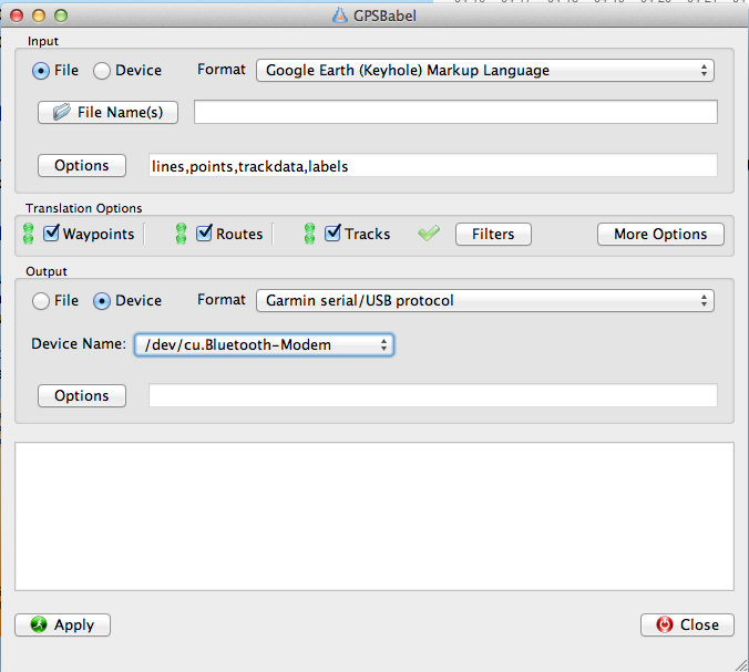
Attachment 8977 You can see it will take a KML and convert to a GPX and feed it straight into your GPS. Been quite a while since Ive done it. There is a file for all DOC boundaries I have in Google Earth. I might check if it can be converted too. I remember the Garmins had limited tiles size it wold allow you to use so would be fairly limiting IIRC.
