
 24Likes
 LinkBack URL
 About LinkBacks
Thought I would share this, maybe you guys already do this?
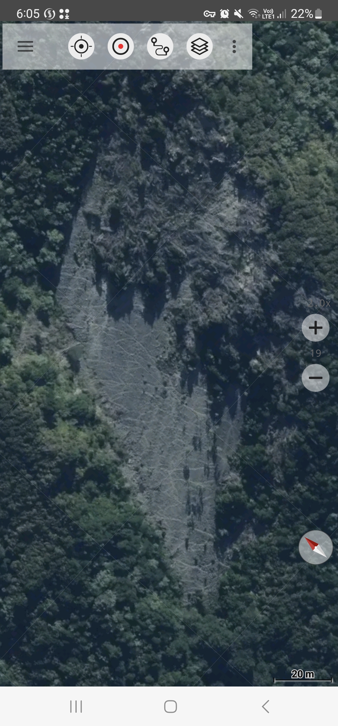
I use Google maps satellite view along side topo50 when viewing to find deer hot spots. Then on the topo50 app I changed to the aerial imagery base map and discovered its much more detailed from above.
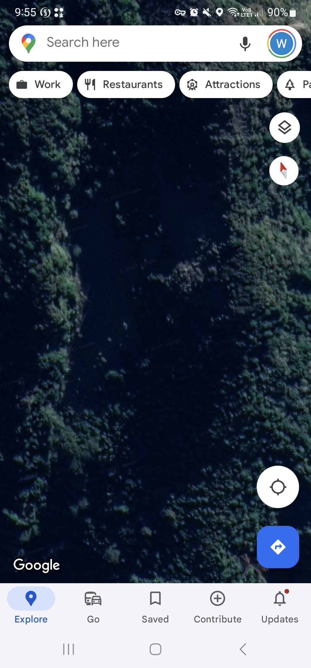
Below is a slip face on spot X from Google earth and its shaded out and can't see anything.
Then using Aerial Imagery on the same area highlights the game trails on that slip face.
Trust this tip is useful for other new hunters.
Welcome guest, is this your first visit? Create Account now to join.
Welcome to the NZ Hunting and Shooting Forums.
Search Forums


User Tag List
Results 16 to 17 of 17
Thread: Maps for finding spot X
Threaded View
-
26-02-2023, 10:02 AM #1Member


- Join Date
- Mar 2022
- Location
- Ashburton
- Posts
- 809
Maps for finding spot X


 Reply With Quote
Similar Threads
-
Finding lost dog.
By Ranal in forum Hunting DogsReplies: 13Last Post: 11-01-2023, 06:02 PM -
Spot satellite messenger, aka findme SPOT
By ROKTOY in forum Gear and EquipmentReplies: 10Last Post: 19-09-2017, 10:44 AM -
finding groper etc?
By silentscope in forum FishingReplies: 11Last Post: 01-11-2014, 09:36 PM
Tags for this Thread
 Posting Permissions
- You may not post new threads
- You may not post replies
- You may not post attachments
- You may not edit your posts
Welcome to NZ Hunting and Shooting Forums! We see you're new here, or arn't logged in. Create an account, and Login for full access including our FREE BUY and SELL section Register NOW!!
All times are GMT +13. The time now is 09:05 AM.

Bookmarks