

 9Likes
 LinkBack URL
 About LinkBacks
This is the EPIX Gen 2 Sapphire.
Ill also briefly report on Topo4GPS, which I have loaded onto it.
What is it for ?
Since using a smartphone app with NZ topographic maps (NZ Topo50), Ive started using that as my primary navigation tool and leaving the Garmin Oregon in the pack, recording tracks and only to pull out when the going gets serious. The Oregon is mechanically worn out, slow to get a fix, screen scratched, and software becoming flakey (not displaying recent tracks after I save them). So, my idea was to get a smaller, lighter GPS for reserve use and managing tracks & waypoints on and off the laptop. The drawbacks Ive experienced of relying on the phone are: poor performance at temp <5C, unresponsive when wet all over, need to recharge from powerbank and possibly fragility.
What is it ?
The Epix is a smartwatch almost identical to the Fenix but it has an AMOLED screen like mobile phones. Among 101 functions, it has GPS (several systems), can display topo maps and a compass. It communicates by Bluetooth to a phone, by cable to a laptop and via your home WiFi to get software. A number of Garmin apps are available including a ballistic calculator called TruFlite. It has no mobile network, no satellite comms and no camera. Waterproofing is said to be 100 ft. Weight is about 80g and of course it sits on your wrist.
Unlike the hand held GPS units, the Garmin watch range is largely oriented towards urban navigation, monitoring exercise and wellbeing and as a prestige fashion item. It has the hardware to do the same job as the GPSMap and Etrex ranges but the software is not really optimised for it.
Model
The one I got is the Gen 2 Sapphire. A pro version is available with a small torch built in and large and small case size options. I suspect this vanilla Gen 2 might be a runout model as it was on special ($1399). This is about twice the price of most hand held GPS and puts it out of reach for most people who would use one. Its entirely possible to travel and hunt with a paper map and a compass and even a cheap second hand hand held will do the job if you want more. You would be better to spend that money on a pair of binoculars, an upgrade to your scope or car or even fifteen hundred dollars of ammo or petrol.
Software
There is a touch screen, which is very responsive just like a phone but most control is done by pushing buttons. There are 5 buttons and 2 or 3 ways of pressing each one, then you go through branching menus that I found quite a steep learning curve. Watch Logic is very different from mouse and touch screen control and I have so much to learn that Ill try and limit myself to talking about what it can do, rather than what I couldnt make it do at this stage. These are the programs you need to download and use with it:
Garmin Connect - communicates between your phone and the watch
Garmin ConnectIQ download and install garmin apps via your phone.
Android File Transfer put third party maps onto the watch
I couldnt get Garmin Basecamp to detect the watch. This program displays maps like Topo4GPS and Maptoaster on your laptop and transfers tracks and waypoints to and from a handheld GPS unit.
Maps
The Epix Gen2 comes with Garmin TopoActive NZ & Australia, which has 100 ft contours. You will want to adjust the phone settings to metric to get scales in metres. This is similar to the old inch to mile series and pretty good in most mountain areas but in flat Kaimai country the 20m contours of the NZ Topo series are a bit better. Mostly the Garmin maps that come with it would be just fine for navigating in the NZ mountains.
I bought the Topo4GPS map for $40 and loaded it into Basecamp, where I was pleased to see relief shading and the contours displayed earlier as I zoom in compared to Maptoaster, which I have used for many years. The map comes as a .DMG file, which you install like a program.
Getting the Topo4GPS map onto the watch was tricky. I had a few emails back and forth with the Topo4GPS people and they solved it. As I said, the Apple Mac Finder program and the Garmin Basecamp didnt display the watch for me. First I used Basecamp to send the Topo4GPS map to a USB stick, which converted it to the Garmin .IMG format needed for Garmin devices to use it. Then, I downloaded a well known program called Android File Transfer which could see the watch and drag-dropped the file, now named gmapsupp.img into the Garmin folder on the Epix watch. It doesnt go in the custom maps folder with the other .img files. Android File Transfer can also transfer files from a Samsung phone to Mac laptop but functionality is quite limited and its a bit of a naughty program, lying dormant and starting up whenever the watch is connected and capturing it, so Ive sent it to the bin now. Anyway, I was then able to go to a settings area on the watch and make the Topo4GPS map the default. When using activities it seemed to revert to the Garmin TopoActive map.
Field testing
Well, this hasnt been too extensive so far but Ill report back on a day of hunting in the Kaimais. I linked together a few nice places Id been to before and used just the watch for navigation.
Locating myself on the map worked just fine. Getting the first fix after switching on takes about 10 seconds out in the open. The unit really needed to be set to utilise all 3 satellite systems (GPS, Gallileo and GLONASS), as it struggled to get a fix under medium canopy if you use just GPS alone. It was good for navigating but usually failed to get a location fix on the default setting.
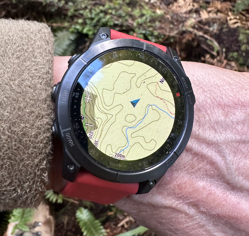
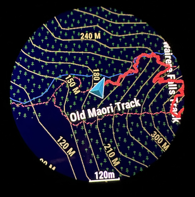
The display was bright and easy to read when I needed it and it quickly fades away to save battery life and avoid shining a bright light around when it isnt being used. This photo is taken using the Map function and shows the Topo4GPS map. Despite the small screen size, it was just as informative as my larger hand held GPS. The view on the smartphone app is a lot bigger of course but the watch was 100% useable for my average eyesight.
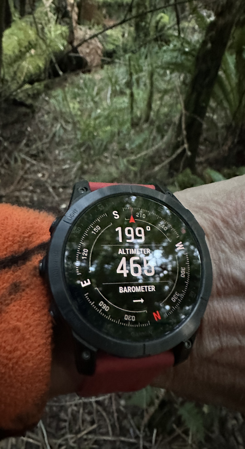
The compass worked well and was easy to read. To be honest, the compass is often the best tool for knowing the right way to go in this undulating country.
As sunset and twilight approached, I felt perfectly comfortable finding my way across a strange ridge and saddle system, back to the track, which was just where the watch said it would be.
The software has several preconfigured "Activities" which display selected screens like the map, compasss, time till sunset, distance travelled and altitude climbed, plus record where you've been. While using Activities such as Hike or Hunt, the watch seemed to revert to the Garmin TopoActive map and I couldnt figure out how to go back to Topo4GPS. Also, I couldnt figure out how to zoom or pan the map while in the Hike or Hunt activities. This actually isnt too bad for fine navigation as the scale seems similar to a paper map, about an inch to a mile, and contours and topography are easy to see. At night, the TopoActive map went into a dark mode to preserve night vision.
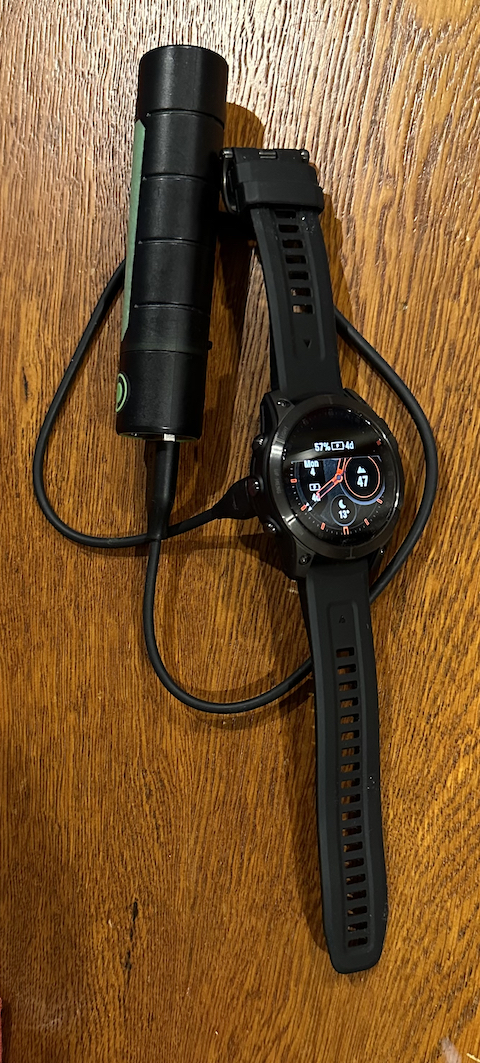
Battery life seemed good. It used up about 25% over a 6 hr day in the bush plus 8hr at home. Using the special Garmin cable, it tops up pretty fast. It went from 40% up to 90% in 37 minutes on a LED Lenser brand powerbank with one 18650 battery in it, and all the 4 charge indicator lights were still showing at the end. You might be carrying this anyway to top up your phone or other devices including some headlamps, so its quite a flexible power system. This should save carrying spare sets of AA NiMH batteries like I had to do with the Oregon.
Welcome guest, is this your first visit? Create Account now to join.
Welcome to the NZ Hunting and Shooting Forums.
Search Forums


User Tag List
+ Reply to Thread
Results 1 to 9 of 9
Thread: Garmin EPIX GPS Watch Review
-
04-09-2023, 10:14 PM #1Member

- Join Date
- Mar 2012
- Location
- Waikato
- Posts
- 1,960
Garmin EPIX GPS Watch Review
-
-
05-09-2023, 09:42 AM #2Member
- Join Date
- Jun 2023
- Location
- Auckland
- Posts
- 220
Hey thanks so much for the great review. My mate has a relatively new Fenix and couldn't get a gps fix in the same areas you were working, which put me off. But, your comments about the gps settings might be the fix. That and line of sight. That's what has put me off about using a gps watch it the bush. I use a Garmin Alpha 200i with the dog and carry spare batteries ($60 each and light as) as one will only last 6-7 hours, and will rapidly drain if cold and wet. I want something like this for quick glances, as faffing about with the Alpha (unnecessarily) has cost me a deer that the pup was locked up on 2 metres away behind a tree.
I think from the way your review reads, and the picture that you have been able to get NZ Topo like detail on the watch? I was able to do this with the Alpha by downloading a file, and it's now got that level of detail, which you need in the bush. The default detail is crap in my view."Death - our community's number one killer"
-
05-09-2023, 10:52 AM #3Purveyor of Fine Cutlery

- Join Date
- Dec 2017
- Location
- Auckland
- Posts
- 702
I have added talky toaster maps to mine - seems a lot better than the stock map.
Regards
Terry
https://www.knives4africa.co.nz/
Custom knife dealer
Authorised Nitecore Torch Retailer
NZ Distributor of Nano-Oil
-
05-09-2023, 11:04 AM #4Member
- Join Date
- Mar 2012
- Location
- Waikato
- Posts
- 1,960
Thanks Terry.
Snopp,
Yes the map detail from Topo4GPS is 100% as good as NZ Topo50 is on my phone, just not as much field of view. The Fenix only has half the number of pixels and a TFT screen so I understand the detail wont be nearly as good. An online reviewer DCrainmaker has a utub vid showing this.
Im told the software on the Fenix is the same as on Epix. The path for adjusting GPS settings is:
#2button menu (at 9 oclock long press till the watch buzzes)
Settings>
System>
Satellites>
All+multi-band
Each menu needs a bit of scrolling to get to the option and I used the touchscreen to do that.Snoppernator likes this.
-
23-09-2023, 09:17 PM #5Member
- Join Date
- Mar 2012
- Location
- Waikato
- Posts
- 1,960
TruFlite Ballistic App for Garmin Watch
This seems to be the only ballistic calculator currently available on the GarminIQ store.
You need to contact the developer and get a bank account to pay money (20USD I think) into, then give him your watch ID and he sends you a licence key, so I expect its locked to your device. Its a bit like the Applied Ballistics security.
Without paying money you can get some limited functionality by changing one of the three common default cartridges.
When you do pay the money, it's fully featured, allowing G1, G7, mix of metric and imperial units, setup scope height, slope, wind, coriolis if you want it, readout in Mils, MOA, clicks, inches or cm. Enough said.
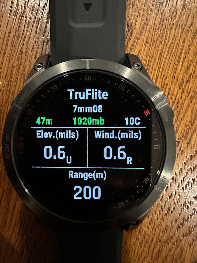
Predictions were within 0.3 mRad of the banned standard app out to 600m for the 7mm08 and to 200m for the 22LR. Evidently, the AB works have been reverse engineered, as several apps are all giving interchangeable results now and its just the interface and libraries that makes some better to use.
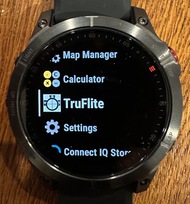
TruFlite icon among apps / activities on the screen:
7mm08 zeroed at 100m, giving come up at 200m with wind hold for 5 m/s full value:
22LR zeroed for 25yd (22.3m) and shooting at 50m:
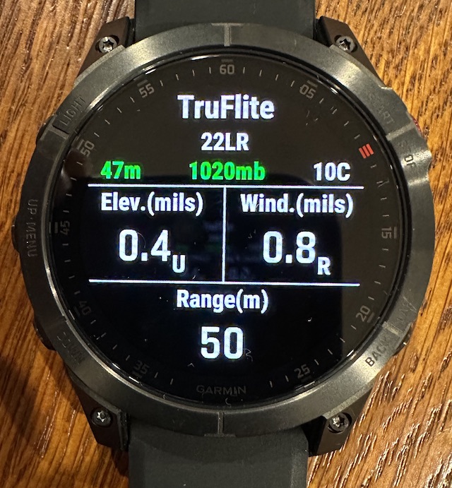
Results from kneeling with 2-4m/s wind from 90deg but not held off for:
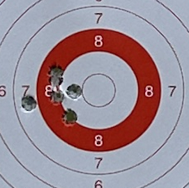
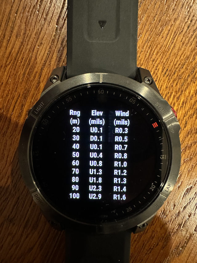
Here is the elevation for the 22, out to 100m.
This facility to display trajectory at any interval (I used 10m steps here) and make up an on the spot range card should be particularly handy for 22 shooting at a variety of distances without needing to reprogram.
It would be nice if you could turn it by 90 degrees to make it easier to use the watch on your wrist while shooting.
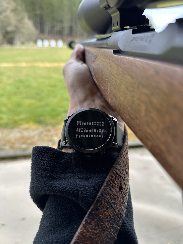
But its still very useable.
I think this is easier to use than an app on your phone and perhaps a bit more adaptable to the conditions on site than a range card stuck onto your stock (which you should have as well for reference).
-
23-09-2023, 10:23 PM #6Gone.................

- Join Date
- Aug 2012
- Location
- Nelson, New Zealand
- Posts
- 9,687
If the fenix is like the Instinct then you should be able to pair your Alpha 200 with it then see distance to dog and direction and you could even leave the Alpha 200 in the top pocket of your pack. Originally Posted by Snoppernator
 All those with dogs waiting no longer fear death. Those with many dogs waiting even welcome it in it's time.
-
24-09-2023, 12:05 PM #7Member
- Join Date
- Jun 2023
- Location
- Auckland
- Posts
- 220
Yeah I think you can. The idea of a quick glance at the watch over unclipping/unzipping the alpha 200 really appeals.
-
26-09-2023, 08:06 AM #8Member

- Join Date
- Mar 2012
- Location
- North Loburn
- Posts
- 4,376
I went for the Fenix 7x Pro Solar. Was on the fence with the Epix because of the better screen but reduced battery life. In hindsight, the latter doesn't matter as extended trips you carry battery pack as you said. The torch function is not a gimic and on an extended Stewart Is trip was surprised how handy it is.
Great review, makes we wish for the Epix with that slick screen.
-
27-09-2023, 10:40 PM #9Member
- Join Date
- Mar 2012
- Location
- Waikato
- Posts
- 1,960
Yes, well sometimes ive wished for a wee light on my wrist since I got this watch
Tikka7mm08 likes this.


 Reply With Quote
Similar Threads
-
Garmin Epix Charger
By Ryan_Songhurst in forum Gear and EquipmentReplies: 3Last Post: 14-08-2018, 12:04 PM -
Garmin watch
By petree in forum HuntingReplies: 18Last Post: 03-04-2018, 05:08 PM
Tags for this Thread
 Posting Permissions
- You may not post new threads
- You may not post replies
- You may not post attachments
- You may not edit your posts
Welcome to NZ Hunting and Shooting Forums! We see you're new here, or arn't logged in. Create an account, and Login for full access including our FREE BUY and SELL section Register NOW!!
All times are GMT +13. The time now is 07:25 PM.

Bookmarks