

 20Likes
 LinkBack URL
 About LinkBacks
Now that's more like it! Definitely look like 1:50,000 now. I wonder what maps they are, as they look different to the LINZ ones that Viewranger uses. What are they called?Originally Posted by SIKAHUNTER

Sounds like a hassle to add the DOC boundaries, I guess i'll just stick to my basic method of drawing them in by having Viewranger open and referencing against the DOC ones.
DOC could definitely make life easier in terms of availability of information. Yes, you can find it on their site, but the site is a total shit fight. It took me quite a while to find the maps with approved hunting areas shaded in, and it still does, and i'm reasonably tech savvy. Not to mention some maps cut off and the hunting area goes off the page, and I assume you have to try and find the block next to it and then put those maps side by side to figure it all out. I haven't had to do that yet, thank fuck. It's no wonder that people get caught out in the wrong areas if you ask me!
Welcome guest, is this your first visit? Create Account now to join.
Welcome to the NZ Hunting and Shooting Forums.
Search Forums


User Tag List
+ Reply to Thread
Results 61 to 75 of 78
Thread: Garmin Monterra GPS
-
17-12-2013, 03:00 PM #61Member

- Join Date
- Aug 2013
- Location
- Christchurch
- Posts
- 449
-
-
17-12-2013, 03:36 PM #62Muppets Inc.

- Join Date
- Jun 2012
- Location
- Napier
- Posts
- 303
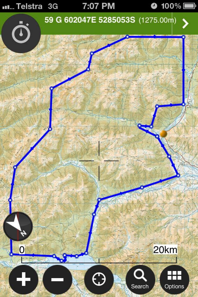
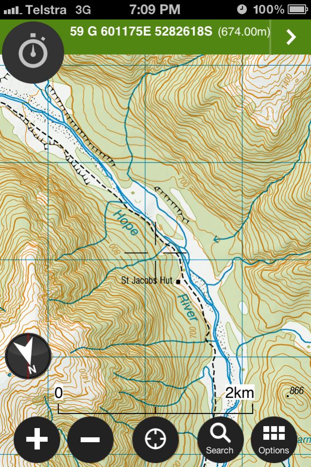
They are from the NZtopomaps database. Might look different because you can select different view options for the same map, eg shading on/off, normal/low/high contrast on/off, night mode or layers on/off. Here's some examples of the same map but with different options enabled. Originally Posted by MattyP
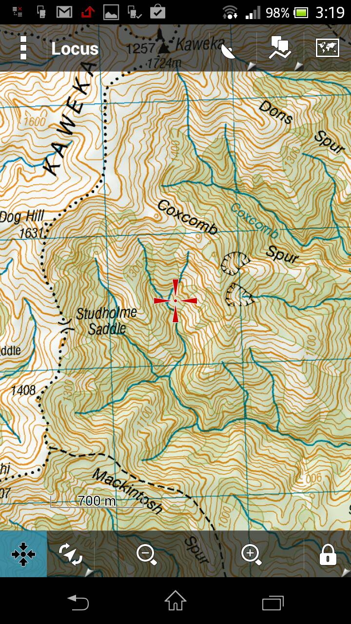
Standard contrast, no shading
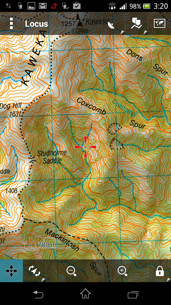
High contrast with shading
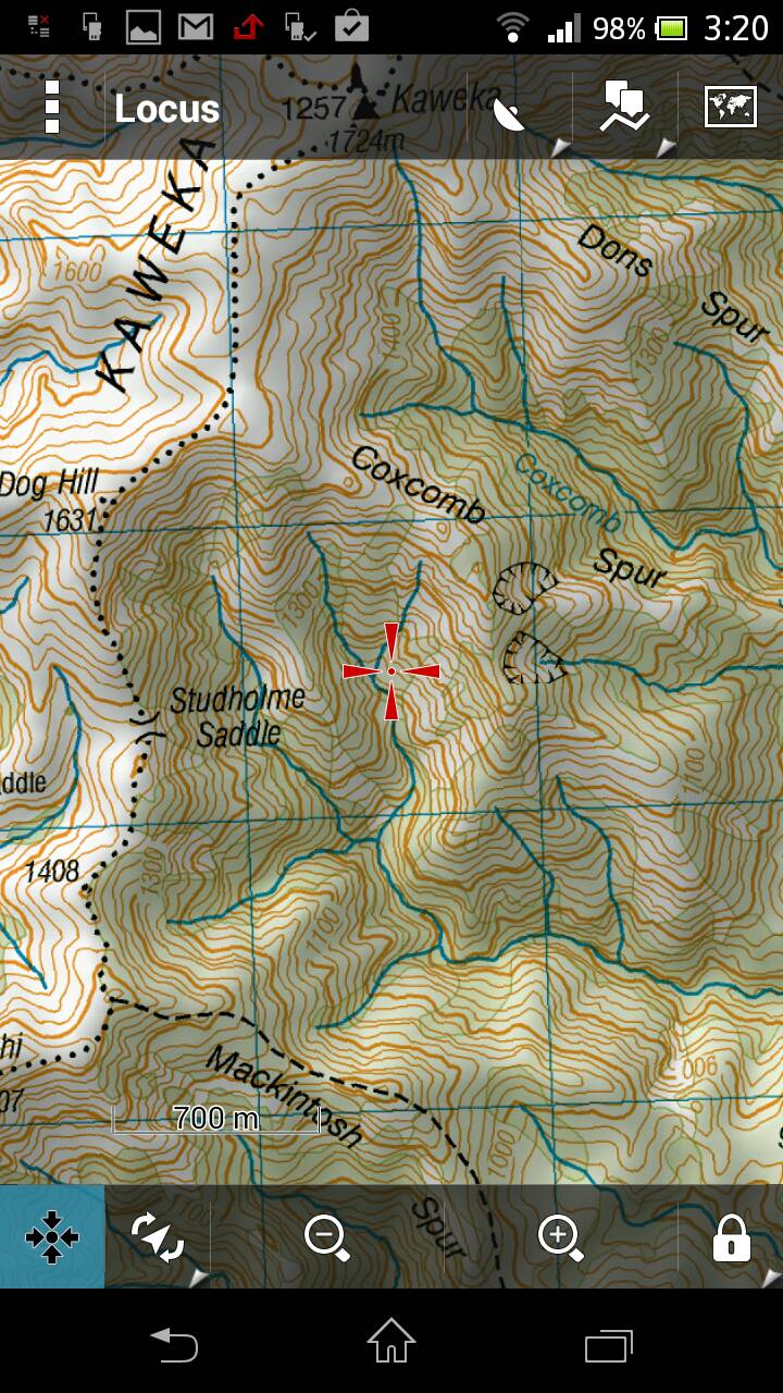
Standard contrast with shading
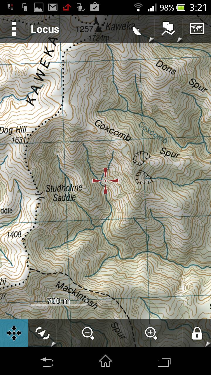
Low contrast with shading
Night mode no shading ;p
I reckon the shading makes the maps almost look 3D.
-
18-12-2013, 10:48 AM #63Muppets Inc.
- Join Date
- Jun 2012
- Location
- Napier
- Posts
- 303
Anyone able to confirm if this file worked? Originally Posted by SIKAHUNTER
Sent from my LT25i
-
18-12-2013, 11:06 AM #64Member
- Join Date
- Aug 2012
- Location
- Christchurch
- Posts
- 4,634
Sorry forgot to try. Will give it a go tonight
-
18-12-2013, 11:44 AM #65Member
- Join Date
- Aug 2013
- Location
- Christchurch
- Posts
- 449
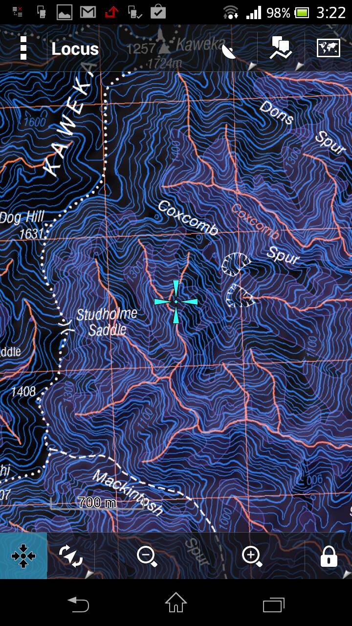
Cool shading options. Viewranger has a night vision mode but no shading options. The maps look better in my opinion though. Here's an example of my drawn in DOC boundaries:
And zoomed in a bit. Can go down to 200m scale along the bottom:
 R93 likes this.
-
18-12-2013, 08:49 PM #66Member
- Join Date
- Aug 2012
- Location
- Christchurch
- Posts
- 4,634
Tried the maps and couldn't get them working, just didn't give me an option to enable the map. Might just be me
-
18-12-2013, 09:58 PM #67Muppets Inc.
- Join Date
- Jun 2012
- Location
- Napier
- Posts
- 303
Did you put it in the [Device]\Garmin\CustomMaps\ directory on your units microSD card? Originally Posted by PerazziSC3
-
18-12-2013, 10:05 PM #68Member
- Join Date
- Aug 2012
- Location
- Christchurch
- Posts
- 4,634
Just tried that. Do I unzip the download?
-
18-12-2013, 10:16 PM #69Muppets Inc.
- Join Date
- Jun 2012
- Location
- Napier
- Posts
- 303
kmz right? Nah it should be able to read it fine.
-
18-12-2013, 10:21 PM #70Member
- Join Date
- Aug 2012
- Location
- Christchurch
- Posts
- 4,634
When I unzip you have a doc.kml and a file with jpgs
-
18-12-2013, 10:29 PM #71Muppets Inc.
- Join Date
- Jun 2012
- Location
- Napier
- Posts
- 303
yeah that's right contents, but don't unzip the kmz contents just try placing the kmz file in as downloaded.
-
18-12-2013, 10:35 PM #72Member
- Join Date
- Aug 2012
- Location
- Christchurch
- Posts
- 4,634
And then just settings, map, select map and it should br there? I have nothing
-
18-12-2013, 10:43 PM #73Muppets Inc.
- Join Date
- Jun 2012
- Location
- Napier
- Posts
- 303
fark knows sorry mate. Unless jpgs are wrong size somehow. I've got a 62s coming so will have a play and let you know.
-
18-12-2013, 10:46 PM #74Member
- Join Date
- Aug 2012
- Location
- Christchurch
- Posts
- 4,634
No worries mate
-
19-12-2013, 08:22 AM #75Codswallop

- Join Date
- Feb 2013
- Location
- The Hill
- Posts
- 23,600
Did you enable it from the maps settings? They dont show everything, only what you enable. Originally Posted by PerazziSC3


 Reply With Quote
Similar Threads
-
garmin 62s
By nork1122 in forum Gear and EquipmentReplies: 9Last Post: 15-07-2013, 04:08 PM -
garmin 62s, which sd card?
By foxhound in forum Gear and EquipmentReplies: 0Last Post: 09-03-2013, 06:19 PM
Tags for this Thread
- 260,
- 300,
- 5000,
- accurate,
- adventure,
- app,
- atlas,
- ballistics,
- bucks,
- buy,
- camera,
- canopy,
- case,
- cheap,
- coast,
- day trip,
- deer,
- device,
- farmer,
- garmin,
- gear,
- gps,
- handheld,
- information,
- iphone,
- kawekas,
- legend,
- loads,
- lost,
- maps,
- offline,
- pack,
- packs,
- pants,
- permits,
- phone,
- plb,
- r93,
- radio,
- rangefinder,
- ranger,
- ranges,
- receiver,
- rino,
- rust,
- satellite,
- sony,
- south island,
- tahr hunting,
- tents,
- test,
- top,
- topo maps,
- trip,
- turn,
- usa,
- water proof,
- waterproof,
- west coast
 Posting Permissions
- You may not post new threads
- You may not post replies
- You may not post attachments
- You may not edit your posts
Welcome to NZ Hunting and Shooting Forums! We see you're new here, or arn't logged in. Create an account, and Login for full access including our FREE BUY and SELL section Register NOW!!
All times are GMT +13. The time now is 04:59 AM.

Bookmarks